
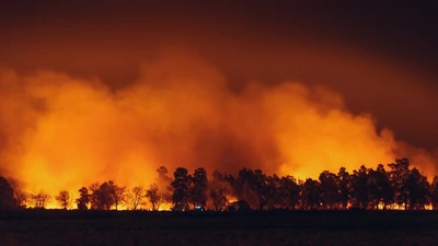
A vegetation fire called the Cornell Fire has broken out in Ventura County, California , burning around 0.23 acres, according to Watch Duty. An evacuation warning has been issued for the Santa Paula 19 zone, while a shelter-in-place order is in effect for Todd Rd. 01.
The fire was reported at around 1:50 a.m. local time on October 16. An Evacuation Warning (Level 2 – Set) has been issued for Zone Santa Paula 19, according to Watch Duty. 01. The Cornell Fire was reported as an approximately 50-by-200-foot vegetation fire burning in heavy fuel, according to Incident Command. The evacuation warning for Santa Paula 19 and the shelter-in-place order for Todd Rd. 01 have also been lifted, according to the Ventura County Evacuation Map.
Incident Command reported that the fire was burning in heavy vegetation, with no structures threatened at the time of the report. No structures were reported threatened in the initial update.
Evacuation orders had been requested in the area, according to Incident Command, but no formal evacuation orders had been issued for any zones at the time of that update. Forward progress on the Cornell Fire in Ventura County, California, has been stopped, according to Incident Command. Check the map here . A Shelter-in-Place Order has also been issued for Zone Todd Rd. Residents can check the Ventura County Evacuation Map for zone details. The fire was listed as active, with no containment percentage provided in the latest information available. The situation may change as firefighters respond and officials issue further updates.
