
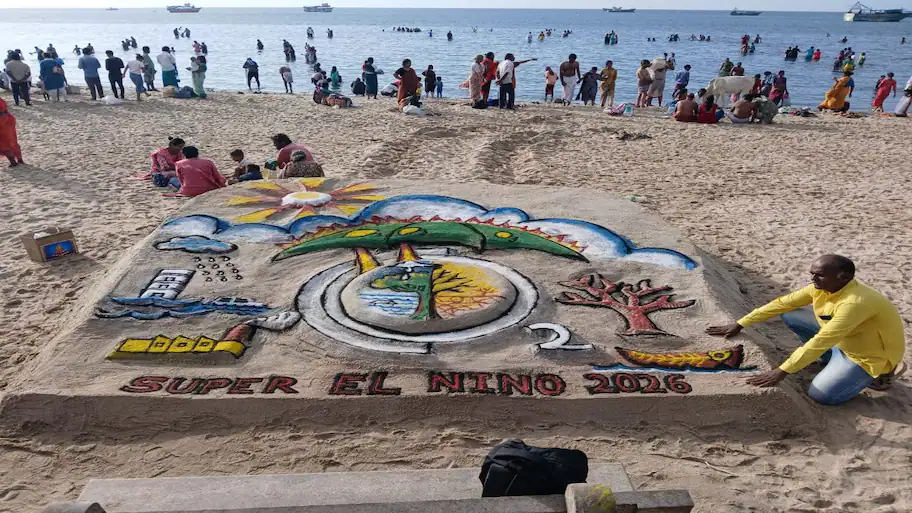
New Delhi: An Indian satellite orbiting 741 km above earth has detected changes in the Pacific Ocean that could mean El Niño is getting stronger in the months ahead. ISRO’s EOS-06, which is also known as Oceansat-3, is tracking changes in the sea and atmosphere over the equatorial Pacific before their possible effects on rainfall and the Indian monsoon become visible.
Data collected by EOS-06 are in line with forecasts from the World Meteorological Organisation (WMO). In June 2026, it said there was an 80 per cent chance of El Niño developing between June and August 2026. By the end of July, the WMO said El Niño conditions were strengthening and could become stronger between August and October 2026. EOS-06 is giving scientists another way to track changes in the Pacific. A large fall in surface chlorophyll-a was recorded in parts of the tropical Pacific in June 2026, according to ISRO’s National Remote Sensing Centre (NRSC) in Hyderabad. The EOS-06 has also recorded changes in the direction of winds over the ocean surface. Long before shifts in rainfall become apparent and before the full impact on the Indian monsoon is felt, ISRO’s EOS-06 satellite, better known as Oceansat-3 satellite, is detecting biological and atmospheric changes unfolding across the equatorial Pacific Ocean. Earlier reporting noted: According to ISRO the observations from EOS-06/Oceansat-3 also complement the World Meteorological Organization (WMO) outlook. In its June 2026 El Niño/La Niña update, the WMO estimated an approximately 80% probability of El Niño conditions developing during June–August 2026, with several forecast models indicating the possibility of a strong event. By late July, the WMO reported that El Niño conditions were intensifying and were expected to strengthen during August–October 2026. Satellite observations from EOS-06/Oceansat-3 reveal a clear decline in marine productivity associated with the developing El Niño conditions across the equatorial Pacific Ocean. Of June 2026 observations revealed a notable reduction in surface chlorophyll-a across parts of the tropical Pacific compared with the same period in 2024 and 2025 when El Nino Southern Oscillation or ENSO conditions were largely neutral, according to analysis by ISRO’s National Remote Sensing Centre in Hyderabad. At the same time, EOS-06 detected a reversal of ocean surface winds from easterlies to westerlies, a classic sign associated with the development of El Niño conditions.
ISRO has released the satellite data and images showing these changes.
Some researchers have even used the term “Godzilla El Niño” for the possible strength of the event. Earlier reporting noted: Title: ISRO Satellite Detects Clearest Sign yet of a Developing “Mother of All” El Niño events From a perch 741 kilometres above Earth, an Indian satellite is tracking what may be the best visible fingerprints of a strengthening El Niño. The satellite data suggest that El Niño is developing, a weather pattern that can influence temperatures, rainfall and storms across several parts of the world. Scientists expect the El Niño conditions to become stronger in the coming months. Several weather models were also pointing towards a strong El Niño. Its data show that biological activity has fallen in parts of the equatorial Pacific, with lower chlorophyll-a levels being one of the main signs. Chlorophyll-a is found in tiny marine organisms called phytoplankton. These microscopic organisms form the base of the marine food chain. The winds have moved from easterlies towards westerlies, which is considered an important sign of an El Niño developing. These observations suggest that the world’s climate system is moving towards a powerful El Niño event that scientists fear could intensify in the months ahead. Some say the Godzilla El Nino is emerging and its true and worst impact is still to be felt. These tiny organisms form the foundation of the ocean food chain.
Earlier reporting noted: The key signal being watched by scientists is a sharp decline in chlorophyll-a, a pigment found in microscopic marine plants known as phytoplankton. ISRO released the data and images today.
How does ISRO track El Niño?
The Ocean Colour Monitor on EOS-06 can detect this change by measuring variations in chlorophyll levels.
Chauhan said the fall in phytoplankton, along with sea surface temperature readings, can provide a clear sign of El Niño conditions and their effects in the Pacific. Dr Prakash Chauhan, director of the NRSC, explained that warm water in the eastern Pacific can prevent cold and nutrient-rich water from deeper layers of the ocean from rising to the surface. When this process weakens, the growth of phytoplankton also falls. The satellite also carries a scatterometer that records changes in the direction and speed of winds over the ocean. These two instruments give scientists information about both the biological and physical changes caused by El Niño. ISRO scientists expect the low-chlorophyll area in the Pacific to become more visible in the coming months if forecasts of a stronger El Niño prove correct.
What makes EOS-06 special?
Scientists compared the readings with the same period in 2024 and 2025, when ENSO conditions were largely normal. The EOS-06 can track both biological and physical changes in the ocean from space. ISRO launched the satellite on November 22, 2022, using a PSLV rocket. The satellite carries the Ocean Colour Monitor-3 and a scatterometer.
Because the ocean’s biological activity can respond to changes taking place below the surface, the chlorophyll readings are useful. Because it has been associated with weaker southwest monsoon rainfall, india keeps an eye on El Niño. SST-based systems usually need temperatures to stay higher for several weeks before an El Niño event can be officially confirmed.
Scientists say a fall in chlorophyll can provide an early indication of El Niño before changes in sea surface temperature (SST) become clear. Chlorophyll data can provide another early signal while those temperature changes are developing. El Niño is the warm phase of the El Niño-Southern Oscillation (ENSO), one of the major weather patterns affecting the planet. Under normal conditions, trade winds push warm water towards the western Pacific. This allows cold water carrying nutrients from deeper parts of the ocean to rise near the coast of South America. During El Niño, these winds weaken or change direction. Warm water moves towards the eastern Pacific and the normal upward movement of cold and nutrient-rich water becomes weaker. This reduces marine productivity and can change weather patterns across different parts of the world. The effects can include changes in rainfall, drought, floods and temperatures in different regions. The weather pattern does not automatically cause a drought in the country. Strong conditions can lead to lower rainfall and affect soil moisture, farming and water resources. Changes in Pacific winds can also affect the larger weather system that helps drive monsoon rainfall over the Indian subcontinent. These instruments track marine ecosystems, ocean winds and changes taking place between the ocean and atmosphere. By combining chlorophyll readings with wind data, scientists can get a near-real-time picture of how the Pacific Ocean is responding to El Niño conditions. The data give researchers another tool to track the development of the weather pattern before its effects become visible through changes in rainfall and temperatures across different regions.
