
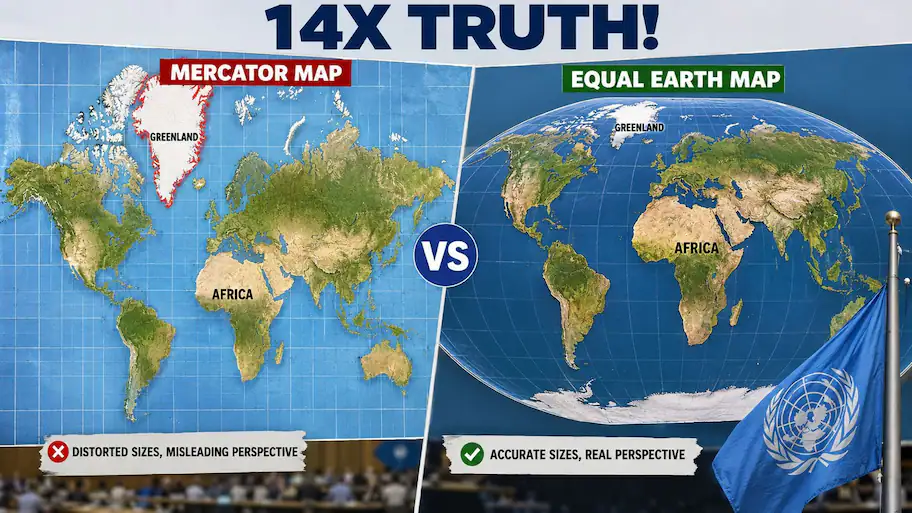
The resolution was supported by 164 nations, and six others abstained; however, the USA was the only country that rejected it. The United Nations General Assembly overwhelmingly voted in favor of a new map that will accurately depict the sizes of the world’s continents.
the USA was the only country to vote against the resolution and criticize the efforts made by the UN to deal with cartography issues instead of addressing modern global crises While 164 nations supported the resolution and six others abstained. First developed in 1569 by Flemish cartographer Gerardus Mercator, the map was designed for nautical purposes, not for depicting actual sizes of continents. Straight lines for compass heading : The Mercator map allowed sailors to maintain straight routes when navigating oceans without using GPS. High latitude distortions : Flattening a spherical shape to a flat rectangle leads to distortions of landmasses located far from the equator.
The Equal Earth projection, which was created by contemporary cartographers in 2018 to fix centuries of distortion, emphasizes accuracy of area rather than navigability. Educational perspective : Supporters say that changing the traditional map size would stop children and students from gaining inaccurate perceptions of geography due to their Eurocentric perspective.
Greenland illusion : According to the classical map, Greenland and Africa were similar in size, while, in reality, Africa is fourteen times larger. Proportionate : Landmasses around the equatorial line, such as Africa, Latin America, South Asia, and Oceania, are now being shown in their accurate proportions compared to northern countries. Implementation around the world : UN member nations are being advised to substitute their traditional Mercator maps with Equal Earth projections in official reports, books, and exhibitions. The resolution, proposed by Togolese Foreign Minister Robert Dussey, led to controversy about the priorities of the institution. The case for visual accuracy : Minister Robert Dussey stated that maps form people’s imagination and educational perception and distortions create subconscious biases for many generations. Washington’s objection : US representative strongly opposed the measure, arguing that the UN was wasting valuable time debating sixteenth-century cartography while global communities face urgent economic and security challenges.
